I am Done Walking

8/21 Katahdin Stream Campground to Baxter Peak (Northern Terminus of AT) to Roaring Book Campground (5.2 AT miles, 9.5 total miles)

We had planned to leave by 5am this morning but none of our alarms went off due to user error, so we didn’t end up heading out until 5:30.  We arrived at the park entrance at around 6 and there was a pretty big line (as the ranger had warned yesterday) to get into the park.  We ended up getting to the base of the mountain at around 7am.  This is later than we had planned, but there was nothing we could do about it at that point.

The hike up was mostly how I remembered it.  The first mile is not to steep, but then it gets steeper and more difficult, until you hit a false summit plateau (it even has a sign to fool you).  All of us (including my dad) were making pretty good time up the mountain, but the higher we got the more that we realized there would not be much of a view from the summit, since it would be clouded in.  We also felt the wind picking up and temperatures dropping.  I had to put a rain coat on (pretty unusual for me) about 700 feet from the summit.We enjoyed a few good views before we became completely fogged in on the southern half of the mountain (there were still some views off the northern side). But we started passing people who were descending from the top, and knew how close we were to the finish.


We finally reached the top, I went directly over to the sign and finished the trail.  It was pretty cold and windy up there so we immediately went about taking our summit photos.  It was pretty disappointing to not have many views from the top, but there’s no way to make the weather co-operate.  It was pretty surreal standing there in the photo that I had imagined taking for the last 5 months.

img_9009

IMG_8044IMG_8075IMG_8074

Unlike most other thru hikers, we decided to descend the north side of the mountain over Knife Edge, which is a very narrow ridgeline across the summit.  At the start we we got to look down on Chimney Pond, which was really pretty, but other than that we were totally fogged in, but still could tell that there were very substantial drops.


Th trail was probably the 2nd hardest mile that I have done yet.  It was very rocky, hilly, and required numerous rock scrambles.  The very very strong winds (sometimes you couldn’t hear yourself talk) and significant fog made the climbing even more challenging.  It was once again disappointing that there weren’t any views, but the fog also made the hiking really cool.

img_9035
We finally reached the end of the Knife Edge trail and the northern peak, and began our descent down.  Luckily, we quickly got below the clouds and were able to get some truly spectacular views.

IMG_8080IMG_8085

I still haven’t fully processed finishing the trail, but there are definitely mixed emotions.  I may put up another post about finishing the trail in the next month or so.


The 2nd to last day

8/20 Hurd Brook Lean-To to Katahdin Stream Campground (13.4 miles)

It was a very odd feeling this morning taking down my tent, knowing that it would be the last time that I do it on the trail.  Stitch and I had a light breakfast since we were going to be stopping at the Abol Bridge (end of the 100 Mile Wilderness) to eat breakfast.

I was disappointed when we got to Abol Bridge.  Our guidebook said that they had subs and breakfast sandwiches.  Instead when we got there all they had was a pretty bad hotel breakfast.  However, we were out of food so we sat down and ate with several other thru hikers.

The rest of the day had some of the easiest trail that we have had on the whole AT.  Not very many roots and really flat.  I was very excited to get to the base of Katahdin, so I was walking very quickly, and reflecting on my whole trip.  It was surprising to me how much I remembered from the last time I did this last section of the AT.

There is so much more water in Maine than the rest of the trail and this last day was a great reminder of that.  We walked along the Penobscot River for awhile, and along or across many of the streams that feed it.  There is just more water moving way faster.  We stopped by the Big Niagara Falls, which was probably the most powerful that we saw on the whole AT.


We arrived at the Katahdin Stream Campground at the 378th and 379th Northbound thru hikers according to the Baxter State Park Register.  I had expected a lot more people to have finished already considering how slow we did the VT and ME.


We waited at the campground for my parents to pick us up since we would be spending the night with them in Millinocket before we summitted the following day.  They came around 2 and took us into town (about an hour drive from the base of the mountain).


We showered, got food for our hike tomorrow, and then went out to dinner.  We all were in bed by 8:30 in preparation for an early start tomorrow.


The 100 mile wilderness


8/14 Monson, ME to Scout and Birman’s Cabin (13.3 miles)

We got off to a late start today since the hostel didn’t start shuttles until 830. Sadly it rained on us all morning. This hasn’t happened in awhile, so we can’t complain too much, but it still put a serious damper on our first day in the 100 mile wilderness.

The terrain today was also rocky and rooty, which was made much more challenging by the the wetness. I had two pretty good falls in the morning, but thankfully I was able to get up with just some scrapes and dirty legs.

We also did our first real ford of a river today. With all the rain the last two days, it was impossible to get across without getting your feet wet. The rocks on the bottom were very slippery, so I had to force myself to go slow and make sure the foothold was secure.


About two miles from our planned stop we came across a trail magic sign. We had been told about this at the hostel, but it was still an awesome way to end the day. Every year Scout and Birdman come out for a few weeks and have hikers over to their cabin (0.2 off the AT) for food and drinks, in memory of Scout’s son who was an avid hiker. It’s these sorts of places that I will miss most about the trail. People opening up their homes to a bunch of random people who are hiking the trail. It’s awesome to hear their stories.

8/15 Scout and Birdman’s Cabin to East Chairback Pond (15.2 miles)

We got off to a late start this morning because Birdman made us (6 total thruhikers) a great blueberry pancake, sausage, and bacon breakfast.

The day ended up being surprisingly challenging. The rocks and roots were still mostly wet, and there were a lot of short and steep ups and downs. It was much more like southern Maine than the type of terrain we have had more recently. There were some pretty good views, and wild blueberries, but nothing as good as what we have seen in southern ME.


We ended up at an awesome campsite right along a pond. It was super peaceful and one of the few times I have had a really nice view right out of my tent.

8/16 East Chairback Pond to Logan Brook Lean-To (15.2 miles)

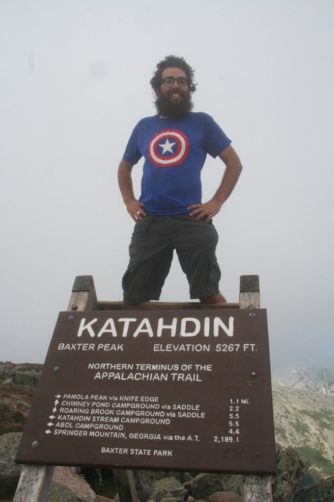
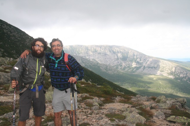
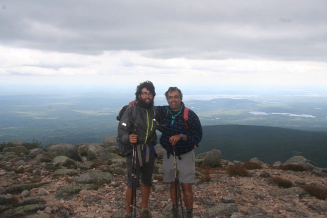
Today we had our last real climb before Katahdin up White Cap Mountain. At the top we had our first real view of the whole mountain and it’s crazy to know that I have walked all this way and can now finally see the end (even if it looks really far away). I have definitely reached the point of having mixed feeling about finishing. I am excited for it, but also don’t want this experience to end. Listening to other thruhikers talk about when they are finishing(and their attempt to delay it) lets me know I’m not the only one feeling this way.


Stitch and I decided to call in quits early today since we are already ahead of schedule and it is supposed to pour rain tonight, so we wanted to make sure we had space in the shelter. It was nice to have a lazy afternoon, and be in my sleeping bag early.

For the first time on the trip I am nervous I won’t have enough food, and might still be hungry after eating my daily rations. This is in part because we were carrying so much food at the start, but also because I have been extra hungry. I am not sure why, but at least I will be finishing with an empty food bag.

8/17 Logan Brook Lean-To to Antlers campsite (19.6 miles)

I was thankful to be in the shelter last night since it did end up pouring rain.  The day started off quite dreary, with light rain until a little after lunch. However the terrain has really flattened out and become a lot less rocky and rooty. Despite the longer distance (at least compared to recently) we were in camp by 3:30 since we were able to move so quickly. It felt more like the mid-Atlantic states than the rest of New England, which was awesome.

When we arrived to camp another thruhiker (Monster) was there with meat that had been left by some other hikers. We got a fire going and reheated it. I probably wouldn’t have eaten it in normal life, but I was pretty hungry and it looked delicious.


The evening turned out to be one of the prettiest on the trail. The sun came out and this campsite is on a lake, so I spent most of the afternoon and evening looking out over it all, taking in my last few days on the trail.

8/18 Antlers Campsite to West Shore of Nahmakanta Lake (13.2 miles)

I woke up to a beautiful sunrise and then got off to a later start since we were doing a shorter day to get back on schedule.

The walk today was very rooty, but since it was so flat we still managed to make good time and were at our campsite by 2pm. It has been really cool in Maine , particularly northern Maine, that we spend so much time walking along larger streams or lakes. It makes the flat sections a lot prettier.

Since it was hot and sunny we decided to go for a swim in the lake when we got here. It was very refreshing, and nice to wash of the sweat and dirt from the past 5 days. However, much to my disappointment, it started to drizzle just as I was drying off. I quickly set up my tent and got myself and belongings inside. It started to rain a little harder, but stopped after about 20 minutes and nothing got too wet. However, the clouds stayed for most of the rest of the afternoon.

It ended up being a beautiful evening to lookout across the lake. The campsites that we have had the last few days have been some of the best on the trail. Sites like these are probably my favorite part about ME.

8/19 West Shore of Nahmakanta Lake to Hurd Brook Lean-To (20.0 miles)

Today was my last day waking up and going to sleep in my tent. I still have not fully comprehended that tomorrow I will be at the base of Katahdin, and will be done the following day.

Today started off with another great sunrise over the lake. The morning had a small climb which once again gave us great views of Katahdin. We were 15 line of sight miles from the peak, but 36 trail miles. Part of this is terrain, but most of it is because the trail zig zags its way up there.


The terrain for the rest of the day was pretty flat and easy once again giving us great views of different bodies of water. We are still running into people who we haven’t seen since the southern states, which has been really cool.

The last few days have been good reminders how much terrain plays into a day’s difficulty. There have been other days when we have done far fewer miles, but climbed mountains over tough terrain, and gotten into camp way later and exhausted. The last few days we have not had any ups and downs and been able to move a lot faster.

Nearing the end

8/6-8/10 Stratton, ME to Pierce Pond Leanto (33 miles)

We did our last major climbs before the 100 mile wilderness. They were tough, but we were treated to some truly awesome views.

The weather continued to be very dry, with all but the large rivers dry. This has meant that we have had to be a little more strategic about where we camp.

Stitch’s friend joined us for the last two days here, luckily after we had finished our big climbs. She did a good job keeping up with us, even though we started doing bigger miles.

Maine has had some very large ponds that often seen more like lakes than they do like ponds. They were mostly a great temperature for swimming so I took advantage of them.


8/10 Pierce Pond Lean to Moxie Pond (15.9 miles)

Today we crossed the Kennebec River by ferry. We got there a little before it opened and there was already a line of 6 hikers waiting for the ferry. The water level of the river was very low (probably 3 feet at its deepest) due to the dry weather. The ferry operator said the river had dropped about 1 ft in the last week.

On the other side of the river we found a hostel that served burgers and milkshakes. We didn’t want to pass up that opportunity, so we stopped in. The waiting for the ferry, coupled with the burger stop, put us well behind schedule.
There was a reasonably big climb in the afternoon, but there weren’t many good views since the river was below 500 feet.

Overall Maine has definitely flattened out. Many of the stream beds are dry, and all of the rivers that often need to be forded are so low they can easily be crossed without getting our feet wet.

8/11 Moxie Pond to Horseshoe Canyon lean to (16 miles)
Last night was a terrible temperature. It was too hot in my sleeping bag and too cold out of  it, along with high humidity. That made it tough for us to sleep well.
We had a steep climb early in the morning, but other than that it was very flat today walking along rivers and streams. This made the miles fly by and was a good reminder about how fast we can go.

8/11 Horseshoe Cayon to Monson, ME (9 miles)

We had a short hike into town, but it started drizzling on us. Thankfully it wasn’t too bad and we managed to stay mostly dry before we got picked up by the hostel.

Since I have already done the 100 mile wilderness (the last 114 miles of trail with very limited road access) I have now hiked the entire trail.  It was a very weird feeling knowing that, particularly because I still had a week of hiking left. I suspect it will take awhile for it all to sink in, even when I complete my thruhike.

After shower and doing laundry we went to the BBQ restaurant (one of two restaurants in town). It was amazing. This is definitely a place that doesn’t have a lot going on in the summer outside of tourism, particularly from the AT. It really started raining in the afternoon, so the hostel really filled up.  I felt lucky that we are going to be inside for the rain for the next two nights.

8/13 Zero in Monson, ME

We had a very lazy zero today.  It was raining on and off all day so we hung out at the hostel.

We decided not to to a food drop in the 100 mile wilderness, so will be carrying 7 days of food. This is the most that I have carried yet, but hopefully it won’t be too bad.

2000 miles

8/3 -8/6 Rangely ME to Stratton ME (32.2 miles)

I have lost some of my blogging motivation so I combined some days.

When we were leaving Rangely Garfield decided that he wanted to go faster than the pace Stitch and I were going to meet our families. We were sad to see him go, but I was happy to have spent so much time with him.

We did a 2 of the 3 big climbs left for us before we reach the 100 mile wilderness. We were treated to some very nice views and have been thoroughly impressed with Maine’s trail maintenance, even if there are a lot of rocks and roots.
There have been several rivers that normally need to be forded, but we were fortunate that it has been so dry that all have been cross able by rock hopping.

We crossed the 2000 mile mark shortly before entering town. It’s odd to think about how that doesn’t seem nearly as far as it did at the beginning.


Gear update: My pole strap broke a few weeks ago, and I was lucky enough to find a broken pole in a hiker box that had a strap I could replace it with. It took awhile to figure out how to do it, but I was able to. It’s amazing how gross they have gotten.

Vacationland

7/31 East B road to South Arm Road (10.1 miles)
Today we did a short slackpack between the two road crossings that go into Andover, ME. The day wasn’t to0 bad at all and we finished our day around 1 pm (although we had to wait another hour for our shuttle to arrive).
Overall, it was a pretty uneventful day of hiking, but we have definitely come to hate seeing a notch on our trail maps for the day. Pretty much all of them involve at least a 1000 ft very steep descent followed by an equal steep ascent afterwards. We can definitely feel our miles slow down the more that we have in a single day.
After making some phone calls I hung out with the owner of the hostel we are staying at for a couple of hours along with a fellow hiker. It was interesting hearing him talk about how his goal each year for the hostel is to break even. They don’t even count the money when you pay them. Moreover, they are staffed by former hikers, many of whom seem to mostly (if not exclusively) get paid with room and board. They are definitely not running a typical business. It seems many, if not most, hostels on the AT operate with this same sort of attitude.


8/1 South Arm Road to Bemis Stream (12.4 miles)
We got off to a late start today, and didn’t hit the trail until 9am. We started the day with a very steep climb that was harder than we had expected looking at the map. It really sucked the energy out of me, and I wasn’t really feeling it most of the day.
We summited a few mountains today, but none of them had spectacular views. I suspect it will continue to be like this (possibly with a few exceptions) for the rest of the trail until we hit Katahdin.
We ended up cutting the day short since we have a short day tomorrow, it looked like it was going to rain, and none of us really wanted to keep going. It ended up being a great choice as it started to rain as we were finishing up dinner.


8/2 Bemis Stream to Rangely, ME (14.0 miles)
Today the terrain really flattened out, and we were able to do 14 miles by a little before 2. This is very different from the last couple weeks when we would be struggling at the end of a 14 mile day. Overall the day was mostly flat terrain. There are definitely a lot of roots and super rocky/root filled steep sections in ME.
We got to the hostel around 2:30 took care of our showers and laundry and headed into town for dinner. The was a BBQ restaurant in town, and we were all able to enjoy it.
We also set our schedule for the rest of the trail.We will be hitting all the big towns in ME, since our finish date to coordinate with our families is pretty late. While the slow pace might be tough on some days, I am looking forward to extending this awesome adventure.
8/3 Zero in Rangely, ME
We all woke up much earlier than we had hoped today. We headed into town to get breakfast and then went out on a canoe for an hour. It was fun the hang out on the water.
After that we went up to the grocery store for a resupply. The store had pretty slim pickings and was overall pretty pricey. It’s weird to think I only have two resupply trips left before we finish.

We hung out at the hostel for the rest of the afternoon and it was nice and relaxing.